|
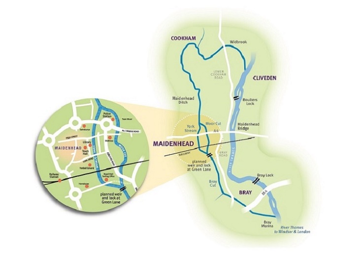
The route of the complete waterway starts at The Thames near
Cliveden Reach, with the main channel running via the White Brook (Widbrook) to its
junction with Strand Water. It then runs southwards via Maidenhead Ditch until it
splits at Town Moor into York Stream and Moor Cut which will form te twon centre waterway 'Ring'.
Town Moor would be an ideal location for a slipway and turning point for boats, with day moorings.
York Stream passes to the west directly into Maidenhead town centre. The previous flood role of
the Moor Cut channel on the east, which is now usually dry, was overtaken by the Jubilee
River scheme.
|
|
 The Group's priority is to restore and enhance the town centre ‘Ring’ and the
southern link to The Thames as a key part of the council's Area Action Plan
for the rejuvenation of Maidenhead town centre.
The Group's priority is to restore and enhance the town centre ‘Ring’ and the
southern link to The Thames as a key part of the council's Area Action Plan
for the rejuvenation of Maidenhead town centre.
Concentrating on this section first brings the greatest benefit to the town
centre at the lowest cost, bringing boats into the heart of the town. The entire
waterway has main river status and an irrevocable right of navigation - despite
this being impractical at present. The enlarged York Stream runs southwards past Hines
Meadow car park, passing through the town centre by the Library and Chapel Arches.
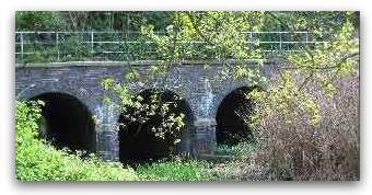
A large water basin has been created next to the restored c1825 bridge, in conjunction with
Shanly Homes' Chapel Arches development.
A second (smaller) water basin has been built on the north side of the bridge, restoring through passage.
The enlarged channel continues down to York Road and then on to rejoin the Moor Cut
channel at Green Lane. A new weir, boat rollers, eel and fish pass was completed at Green Lane in 2020, which has lifted and
stabilised water levels right through the town centre. Once funding can be secured to complete the eastern Moor Cut channel,
the town centre ’Ring’ will allow navigation into and around the town centre, initially by small boats. The planning consent includes
provision for a lock alongside the weir, but it is not planned to build this until such time as boats large enough to need a lock
can reach the weir.
|